The world is brimming with data, and Verso’s remote sensing services unveil a new dimension of insights for informed decision-making. Through cutting-edge technology and scientific expertise, we capture, analyze, and interpret data from a distance, empowering you to see beyond the surface. Whether you’re managing natural resources, monitoring environmental changes, or planning for resilient infrastructure, our remote sensing solutions offer a bird’s-eye view that transforms data into actionable knowledge.
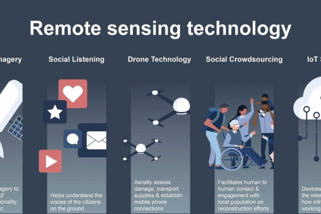
At Verso, we understand that data without context is like a puzzle missing crucial pieces. Our remote sensing experts combine data from various sources, such as satellite imagery, aerial photography, and ground-based sensors, to create a holistic and accurate picture of your area of interest. We employ advanced techniques in image processing, pattern recognition, and data fusion to extract meaningful insights that drive smarter decisions.
Verso’s remote sensing services extend beyond analysis; they encompass a journey of discovery. We don’t just provide data; we guide you through the interpretation process, helping you unlock patterns, trends, and correlations that may otherwise remain hidden. Our goal is to empower you with actionable intelligence that can drive impactful decisions, whether in disaster response, agriculture, land use planning, or beyond. Step into a new era of informed decision-making with Verso’s remote sensing solutions, where data transforms into knowledge and knowledge becomes power.